 |
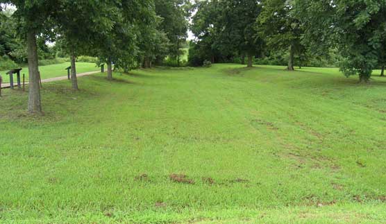
| Remaining Section of Grant's Canal (NPS) |
Numbers 4. Reports of Captain Frederick E. Prime, U. S. Corps of Engineers, Chief Engineer, of operations January 30-May 4.
STEAMER MAGNOLIA,
Camp opposite Vicksburg, MISS., January 30, 1863.
GENERAL: I have the honor to forward herewith tracing of point opposite Vicksburg. The dotted line at the entrance of the canal shows the new direction so as to correspond with the course of the current. Ground was broken to-day. Tomorrow I shall try and dam the canal at the point marked, not having any levels but such as used by masons. I shall then be enabled to obtain the approximate difference of level between the water level at the entrance and exit of the canal. At present it is variously estimated from 28 inches to 3 feet. The velocity, as roughly measured to-day by using a floating body, was 422 feet in two minutes. I shall commence making a few fascines and gabions tomorrow. There is difficulty in procuring proper materials for withes and for gabions in the immediate neighborhood.
Should circumstances require the expedition to remain here for some length of time, and the river continues to rise, there will be much trouble from the backwater in the swamps coming from the crevasses in the levee. There is a crevasse above here, as shown on the map, which in a few days will probably be repaired. About 2 1/2 miles above the mouth of the Yazoo River there is another and more troublesome crevasse, which I have not been able to examine, nor have I any person to send. There is also another crevasse some 10 or 12 miles below here. The earth from the new entrance to the canal will by used on the east side to from a species of levee connecting with the old leave, in order to prevent the current (in case it should show a tendency to cut) from expending it self on the low land outside of the levee when the old levee is passed. The levee, as stated in my previous letter, is being constructed on the WEST side, in order to prevent the camping ground from being inundated.
I shall continue to give the Department all information that I can obtain in connection with the engineer part of the expedition. As I have no means or time to keep copies of my letters, any repetitions must be laid to that cause.
I am, general, very respectfully, your obedient servant,
FREDERICK E. PRIME,
Captain of Engineers.
Brigadier General JOSEPH G. TOTTEN,
Chief Engineer of the Army, Washington, D. C.
Official Records, Series I., Vol. 24, Part 1, Page 117.
Although the canal below Vicksburg described here is known as "Grant's Canal" it was actually begun in 1862 when the first Federal troops (3,000 under General Thomas Williams) came to the area. The idea was to the point where Vicksburg's guns commanded the river and eventually change the course of the river there, leaving the Confederate citadel high and dry. Grant lacked confidence in the idea but believed it would keep his troops (who labored alongside African-Americans impressed into service) healthy by means of activity. The project stopped when a sudden rise in the river broke a dam and flooded the canal with sediment. Attempts to bring in a dredge were defeated when Confederate artillery drove them away. By March the attempt was abandoned as Grant pursued more aggressive siege operations.

No comments:
Post a Comment